
ConstructViewSolutions

Construction documentation

A clearer visual record from one milestone to the next.

ConstructView supports project teams with recurring aerial capture, repeatable viewpoints, mapping, 3D documentation, and organized delivery—making progress easier to review without relying on scattered photos.

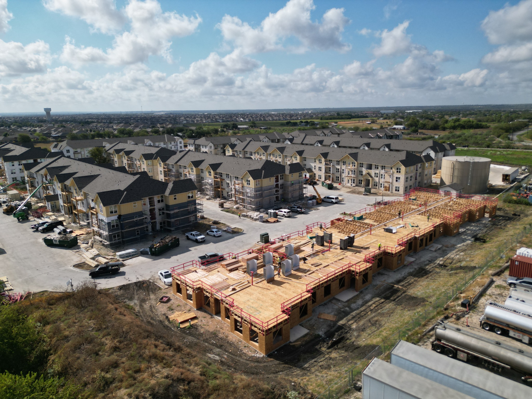
Elevated aerial documentation of residential construction in progress
Construction progress documentationConstructView capture

Construction service levels

Match the capture program to the project.

Construction pricing is custom because project size, location, capture frequency, duration, access, and required deliverables directly affect the scope.

Basic

Site Monitoring

Simple recurring visual documentation for teams that need a reliable aerial record of current site conditions.

  • Scheduled drone flights
  • High-resolution aerial photography
  • Aerial video and 360° site flyovers
  • Organized digital delivery

Standard • Primary

Progress Tracking

Repeatable documentation designed to make progress easier to review across the life of the project.

  • Weekly or biweekly drone flights
  • 2D orthomosaic mapping
  • 3D site models where applicable
  • Repeatable progress viewpoints
  • Aerial video and 360° site flyovers
  • Progress reporting and visual comparisons

Premium

Advanced Site Capture

A broader visibility package that connects exterior progress with interior 3D documentation and enhanced reporting.

  • Everything in Progress Tracking
  • Interior Matterport / 3D documentation
  • Priority scheduling
  • Enhanced reporting

Available deliverables

Useful views for site teams and stakeholders.

Deliverables are selected based on the project’s goals, site conditions, software compatibility, and approved flight area.

Aerial photography

High-resolution site overviews and targeted areas of interest.

Aerial & 360° flyover video

Edited site movement, full-site orbit coverage, and surrounding context for updates and presentations.

2D orthomosaic mapping

A stitched overhead site view where capture conditions and scope allow.

3D site documentation

Three-dimensional site models where applicable to the project.

Interior 3D capture

Matterport or 360° documentation for selected interior areas.

Progress reporting

Organized updates, comparisons, and selected visual references.

How recurring service works

Set the baseline. Repeat the capture. Organize the record.

01

Define the scope

Confirm the project area, safety and access considerations, deliverables, and reporting goals.

02

Set the schedule

Establish a weekly, biweekly, milestone, or project-specific capture cadence.

03

Deliver consistently

Receive organized imagery, video, mapping, models, or reports based on the approved scope.

Scope boundary

ConstructView provides visual documentation and media services. The work is not represented as land surveying, professional engineering, building inspection, roof inspection, or another licensed professional service. Mapping and models are provided for documentation and visualization unless a separate qualified professional is engaged.

Build a capture plan around your project schedule.

Share the project address, size, duration, preferred frequency, and required deliverables for a custom construction quote.

Get a Custom Quote